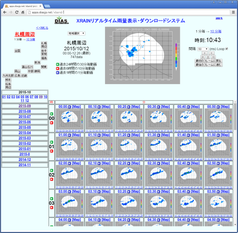
The XRAIN Realtime Precipitation Data enables users to display rainfall information in 250 m grid images superimposed on a map – a resolution 16 times higher than the existing wide-area radar – for a specified region and time, and to check developments by still image or time-segment animation. The observation time is short at just one minute, making it possible to confirm rainfall patterns as a whole in almost real time and verify detailed information for each region per minute. Furthermore, general users can also download rainfall data for a specific region in an easy-to-handle format. This enables the easy analysis of data previously only available to users in command of advanced data processing techniques and is anticipated to expand the scope of weather forecasting research using rainfall observation data.
*Available only in Japanese
HOW TO USE
DIAS account is necessary. It will ask the purpose of using the XRAIN only for the first time. Please contact the DIAS Office for details:
Login
XRAIN Real-time Rainfall Display and Download System
http://apps.diasjp.net/xband/


